

High-resolution Atmosphere Modeling
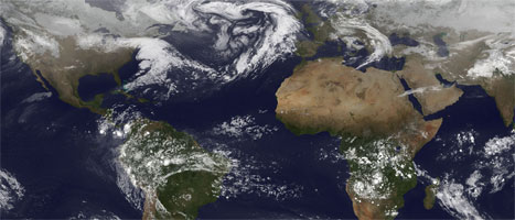


Much of the most destructive behavior of the atmosphere occurs at scales of a few hundred down to a few kilometers. However, many high-impact weather events cannot be directly simulated in low-resolution climate models. Hurricanes only appear as weak lows in low-resolution models, and severe thunderstorms do not appear at all. Less intense but no less important are persistent features due to small-scale topography. Much of the precipitation in mountainous regions, so often critical for water supply in the surrounding region, is forced by small, steep slopes. Even larger-scale climate patterns are affected by smaller-scale features. Drag and blocking by mountains critically alters the global circulation of the atmosphere, and gravity waves caused by tropical thunderstorms cause a reversal of stratospheric winds about every 13 months.
Computer models that cover only a small part of the earth, so they can be efficiently run at resolutions which show features only a few kilometers across, have been crucial to our understanding and to short-term forecasting of how these systems form and develop. Questions still remain regarding large-scale processes controlling where and when these high-impact systems occur, how well models can reproduce observed frequencies and strengths, both on average and from year-to-year or season-to-season, how small-scale features alter large-scale circulations, and how global warming or other human-made effects (such as air pollution or land-use changes) affect these systems.
GFDL Research
The High Resolution Atmosphere Model – HiRAM – is a global model designed to run efficiently at high enough resolution to capture hurricanes, thunderstorms, and the effects of mountains. It uses a simpler representation of aerosols (dust and pollution) than does the AM3 model so that it can run efficiently at higher resolutions, and uses a new scheme to represent convection and thunderstorms which are still too small for the model. This scheme allows the atmosphere to build up energy so that more intense behavior can occur, and in particular allows hurricanes to form more readily than with other such schemes.
HiRAM was first used to model the global frequency of hurricanes and tropical cyclones. If the model was run with observed sea-surface temperatures, the year-to-year changes as well as the 30-year trend in Atlantic hurricanes was very well represented in this model. Further research has found that HiRAM can predict the number of Atlantic hurricanes each summer with a very high accuracy. Further work with HiRAM as well as work with the GFDL limited-area hurricane model has found that under global warming we expect the total number of tropical cyclones to decrease, but the number of the most intense storms to increase.
HiRAM, as well as nearly all other global weather and climate models, currently does not explicitly compute vertical accelerations, which are negligible on the scales global models are typically run, but become important for thunderstorms and some mountain flows less than 10-15 kilometers wide. A new version of HiRAM to include these “nonhydrostatic” effects is being developed.
Work is underway to be able to run the model at even higher resolutions over a small part of the world either by distorting the grid (grid stretching) or by adding a small, higher-resolution grid (grid nesting).
Related Links
- Quickstart Guide: FMS doubly periodic HIRAM
- HiRAM
- TStorm Tropical Cyclone tracker
- CMIP5 HiRAM (c180 and c360) data
Research Highlights
- Kilometer-scale global warming simulations and active sensors reveal changes in tropical deep convection
- Atmospheric rivers over eastern US affected by Pacific/North America pattern
- Regulating finescale resolved convection in high-resolution models for better hurricane track prediction
- Simulations of Atmospheric Rivers, Their Variability and Response to Global Warming Using GFDL’s New High-Resolution General Circulation Model
- Skillful Prediction of Monthly North Atlantic Major Hurricane Activity with Two-way Nesting