High Resolution Simulation of the Pacific Storm Track
The ZETANC developed at GFDL is a high resolution, non-hydrostatic, fully compressible model of hemispheric extent. The model is being used for the simulation of the detailed structure of extra-tropical storms and storm tracks. The studies are aimed in particular at a more definitive understanding of the effects of moist convection on storm structure and evolution. These simulations will be used to evaluate parameterizations in global climate models. The model will also will be used to study the seasonal cycle and inter-annual variability of the storm tracks and their sensitivity to climate change, placing particular emphasis on extreme extra-tropical weather.
ZETANC could be used to simulate phenomena at any meteorological scale since it does not require the standard restricted assumptions. In order to illustrate the versatility of the model, two extreme experiments are shown: a) Bubble convection in an isentropic environment, and b) the life-cycle of baroclinic eddies.
Medium Resolution (avg Dx ~ 26km)
Recent experiments, performed with the non-hydrostatic model ZETANC, are being used to study the sensitivity of the winter storm track to changes in SST. These different SST distributions portray the interannual variability of the Pacific Ocean sea surface temperature associated with ENSO and also the estimated surface temperature changes in global warming scenarios. The model covers 1/6 of the globe (with variable horizontal resolution), with 56 levels reaching to 25km height. These solutions, without the limitation of cloud parameterizations, will provide unique model datasets that could help address a number of pending questions in weather, climate and climate change:
High Resolution (avg DX ~ 13km)
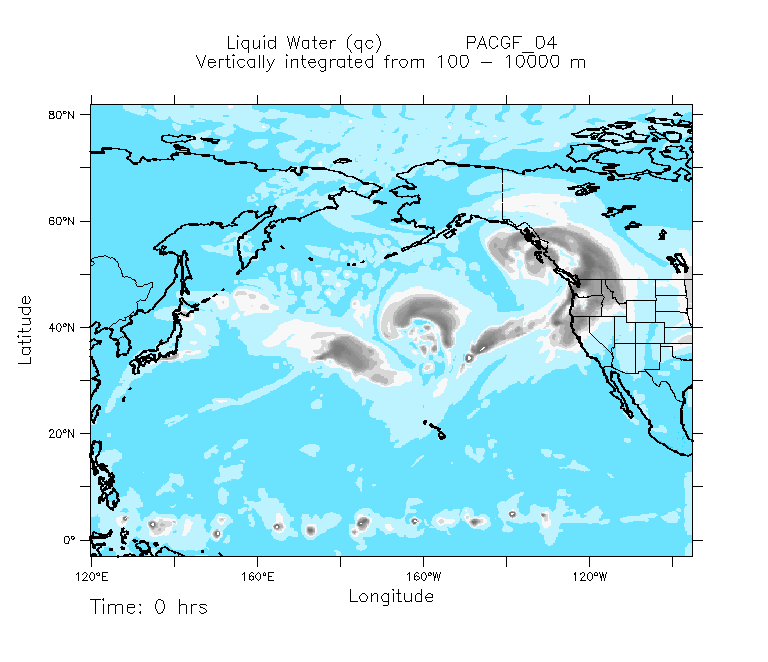
The figures shows a snap-shot (203 day 16h) of the column integrated cloud water (3 levels: from 0-3000m, from 3000m to 6000m and 6000m to 15000m) from the two resolutions simulation of the Pacific storm track. The region covers from west of Asia to the west coast of North America. Different types of clouds are seen in the figures, most of them around cyclone-frontal systems characteristic of winter conditions over the extra-tropics. A large area of cloud water that extends from the tropical to sub-tropical latitudes (ITZC) is also identified. This simulation details realistic features like the rain band ahead of the cold front and the cloud wrapping around the cyclonic circulation. It is interesting to note that although clear difference in the structure of the cloud types are shown between the medium and high resolution explicit convection cases, the gross features of the clouds around the extra tropical storms are very similar.
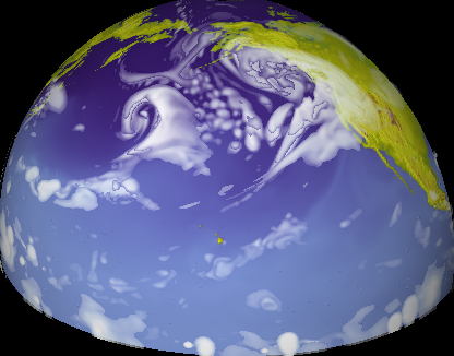
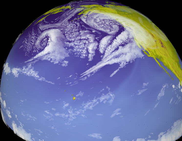
The Pacific Storm Track
The Convection associated with the synoptic scale activity along the storm track is shown in this short time sequence ( every 8 hours over 64 days) animation.
The eddy activity along the storm track has been simulated without the standard moist parameterizations. Actual individual clouds are explicitly resolved in these runs using explicit moist convection in the non hydrostatic compressible hemispheric model ZETANC. The animation shows only a very small portion of the total integration. The integrated column of liquid water is shown in gray.
The domain shown is 145 degrees in longitude and from 3S to 83.5N in latitude, 25km in height.
The numerical domain has been done in various resolutions: 435Xx361, 871×723 and 1742×1446 points in the horizontal and 56 layers in the vertical, the stretch vertical coordinate has DZ min=98m. and DZ max =1700m. The minimun Dx=3.7km, the Dx, Dy~20km, 10km and 5km in the middle of the domain (40 Lat.)