February 11th, 2020
Key Findings
- This study examines how landslide activity within High Mountain Asia may change, as a result of future changes in extreme precipitation
- Results suggest that increases in extreme precipitation will cause increases in potential landslide activity across the study region, with greater impacts near glacial lakes.
- Population projections alter the results, increasing or decreasing the exposure of populations to landslide risk
- The rate of increase in landslide activity at the end of the century is expected to be greatest over areas covered by current glaciers and glacial lakes
- The study demonstrates that global climate models and satellite observations can be used to model landslide impacts at timescales affected by anthropogenic climate change.
Dalia Kirschbaum, Sarah Kapnick, Thomas Stanley, Salvatore Pascale. Geophysical Research Letters. DOI: 10.1029/2019GL085347
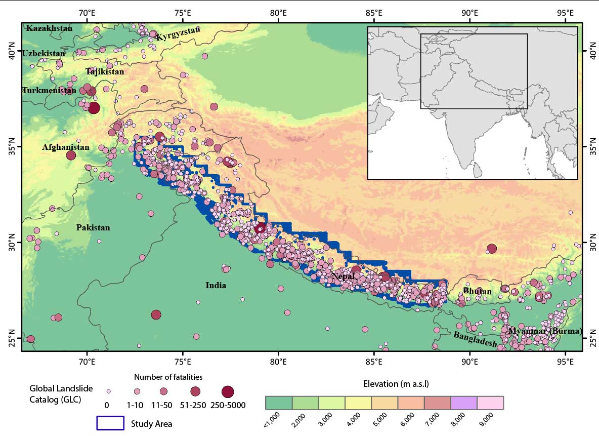
High Mountain Asia is home to both monsoonal rains and the largest concentration of glaciers outside the North and South Poles. With climate change, heavy rainfall will increase, especially in mountains near glaciers and glacial lakes. This will make landslides more likely and could present new hazards of landslides releasing a wall of water from glacial lakes, impacting communities and infrastructure located downstream.
This interdisciplinary investigation melded the unique strengths of two federal agencies to conduct a novel study that quantitatively examined how climate change, and specifically changes in precipitation extremes, will alter landslide risks over High Mountain Asia. The authors combined a landslide database and a dynamic landslide model developed at NASA, satellite data, and a high resolution GFDL global climate model, to explore changes in landslide risks due to climate change in High Mountain Asia. This study provides both relevant scientific results and a new framework for combining a large ensemble of global climate model simulations with satellite data and a landslide model.
GFDL’s FLOR model was used to create a reanalysis-style record of extreme rainfall, for direct comparison with satellite observations (from NASA’s Tropical Rainfall Measuring Mission); a 30-member FLOR ensemble in the present (1961-2000) and future (2061-2100); and a landslide catalogue and model developed at NASA. The results allowed the authors to explore how landslides are affected by precipitation extremes in the current climate and how landslides will change in the future due to changes in extreme precipitation.
The authors found that extreme precipitation will occur more frequently in the high mountain Asia region by the end of this century. Those changes in precipitation lead to increases in landslide risks in many parts of the region. The locations with the greatest increase in landslide risk are collocated with regions having a high concentration of glacial lakes, increasing the likelihood for cascading hazards (e.g., a landslide could breach a lake, causing massive flooding downstream). The most significant projected increases in potential landslide activity occur in the transition zone between the Himalayan Mountains and Tibetan Plateau along the Nepal-China border, with the largest changes during the summer months when the monsoon brings in the majority of the extreme rainfall within this region.