May 8th, 2018
Key Findings
- HiRAM faithfully reproduces the modulation of TC statistics in the Gulf of Mexico by the ISO.
- The satisfactory performance of HiRAM likely results from its realistic representation of the large-scale anomalies associated with Northeast Pacific ISO.
- HiRAM has potential for skillful sub-seasonal prediction of regional TC risk
Kun Gao, Jan-Huey Chen, Lucas Harris, Shian-Jiann Lin, Baoqiang Xiang and Ming Zhao. Journal of Geophysical Research: Atmospheres. DOI: 10.1002/2017JD027756
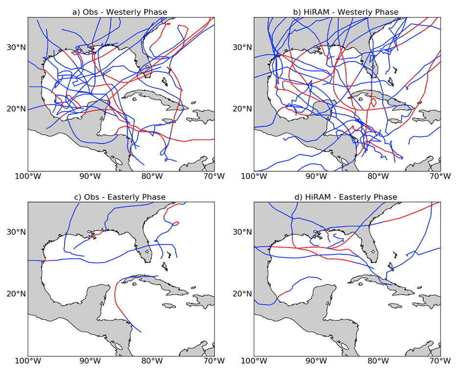
The Tropical Cyclones (TCs) that form over the Gulf of Mexico have a high probability of making landfall at the surrounding coastal regions, causing severe property damage and loss of life. Skillful sub-seasonal prediction of TC activity is critical for early preparation and reducing damage in this region. In order to have skillful prediction of sub-seasonal TC activity, it is important for dynamical models to faithfully capture the Intraseasonal Oscillation (ISO, or the Madden-Julian Oscillation) characteristics and also its impact on TC activity, such as the frequency of TC formation and landfall. It has been established that ISO modulates TC activity in the Gulf of Mexico region by affecting the large-scale environment, increasing the likelihood of TC genesis when it is in a convectively enhanced phase.
Previous studies have suggested that global models generally have deficiencies in simulating the climatology and the variability of TC activity over the Gulf of Mexico region. In this study, the authors evaluate the performance of GFDL’s global HIgh Resolution Atmospheric Model (HiRAM) in simulating the modulation of TC activity in the Gulf of Mexico and western Caribbean Sea by ISO, based on multi-year retrospective seasonal predictions. The authors demonstrate for the first time that HiRAM faithfully captures the observed influence of ISO on TC activity over the region of interest, including the formation of tropical storms and (major) hurricanes, as well as landfalling storms. This is likely because of the realistic representation of the large-scale anomalies associated with boreal summer ISO over the Northeast Pacific in HiRAM, especially the enhanced (reduced) moisture throughout the troposphere during the convectively enhanced (suppressed) phase of ISO.
The successful performance of HiRAM over this region likely results from a combination of the use of relatively high horizontal resolution (~25 km), advanced non-hydrostatic dynamical core (FV3) and upgraded convection parameterizations. This work strongly suggests the potential of HiRAM for the subseasonal prediction of regional TC risk.