

“ZETANC” A MODEL FOR ALL SEASONS
The ZETANC developed at GFDL is a high resolution, non-hydrostatic, fully compressible model of hemispheric extent. The model is being used for the simulation of the detailed structure of extra-tropical storms and storm tracks. The studies are aimed in particular at a more definitive understanding of the effects of moist convection on storm structure and evolution. These simulations will be used to evaluate parameterizations in global climate models. The model will also will be used to study the seasonal cycle and inter-annual variability of the storm tracks and their sensitivity to climate change, placing particular emphasis on extreme extra-tropical weather.
ZETANC could be used to simulate phenomena at any meteorological scale since it does not require the standard restricted assumptions. In order to illustrate the versatility of the model, two extreme experiments are shown: a) Bubble convection in an isentropic environment, and b) the life-cycle of baroclinic eddies.
The Convection of a buoyant bubble is shown in this short time sequence ( every 30 sec over 12 minutes) animation. For a larger version click here.
Bubble Convection
The initial bubble is circular, 50 meters in diameter and weakly buoyant. As the bubble rises it develops two vortices centered on its sides (Hill vortices). The upward velocity is larger at the bottom than at the top. This differential velocity causes the bubble to deform with a classical mushroom shape. Since the bubble is not very buoyant individual convective cells are produced in its periphery. Probably, Kelvin-Helmholtz instability is produced on the sides by the strong circulation. I selected this experiment because was reported in the literature by Andre Robert “Bubble convection Experiments with semi-implicit Formulation of the Euler Equations. J.A.S 1993”.
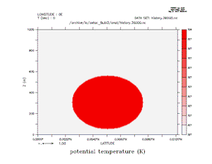
The initial bubble is 0.5 degree Centigrate warmer than the environment. The size of the domain is 1000mts height by 1000 mts width. A grid size of dx=dz=5mts. and dt=0.01 sec and second order diffusion of 0.3 m*m/s. The change in color is because, I did not fixed the scale for all the frames in ferret.
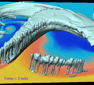
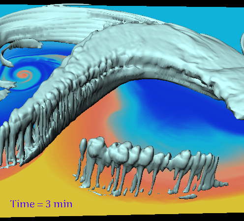
The Convection associated with the Cyclone- Frontal system is shown in this short time sequence (every 3 minutes over 210 minutes) animation. For a larger version click here.
Cyclone and Frontal System
The successful numerical simulation of a planetary wave with the Cyclone-Frontal System and convective rainbands is displayed. Probably for the first time a planetary scale circulation has been simulated without the standard moist parameterizations used in other GCM’s. This simulation details realistic features like the rain band ahead of the cold front and the cloud wrapping around the cyclonic circulation.
The life cycle of a moist baroclinic wave has been simulated without the standard moist parameterizations. Actual individual clouds are explicitly resolved in these runs using explicit moist convection in the non hydrostatic compressible hemispheric model ZETANC. The animation shows only a very small portion of the baroclinic life-cycle. The surface temperature is displayed from yellow (warm ~20C) to blue (cold ~ -10C). the isosurface of liquid water (0.2 g/kg) is shown in gray. The domain shown is 50 degrees in longitude and from 15N to 65N in latitude, 30km in height. The numerical domain has 640×640 points in the horizontal and 56 layers in the vertical, the stretch vertical coordinate has DZ min=220m. and DZ max =1700m. The minimum Dx=3.7km, the maximum Dx, Dy= 8.7km and in the middle of the domain (40 Lat.) Dx= 6.6 km