June 4th, 2019
Key Findings
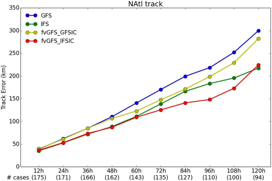
- The GFDL fvGFS retrospective forecasts initialized with the European Centre for Medium-Range Weather Forecasts data showed better track forecasts for the 2017 Atlantic hurricane season compared to the best performing ECMWF operational model.
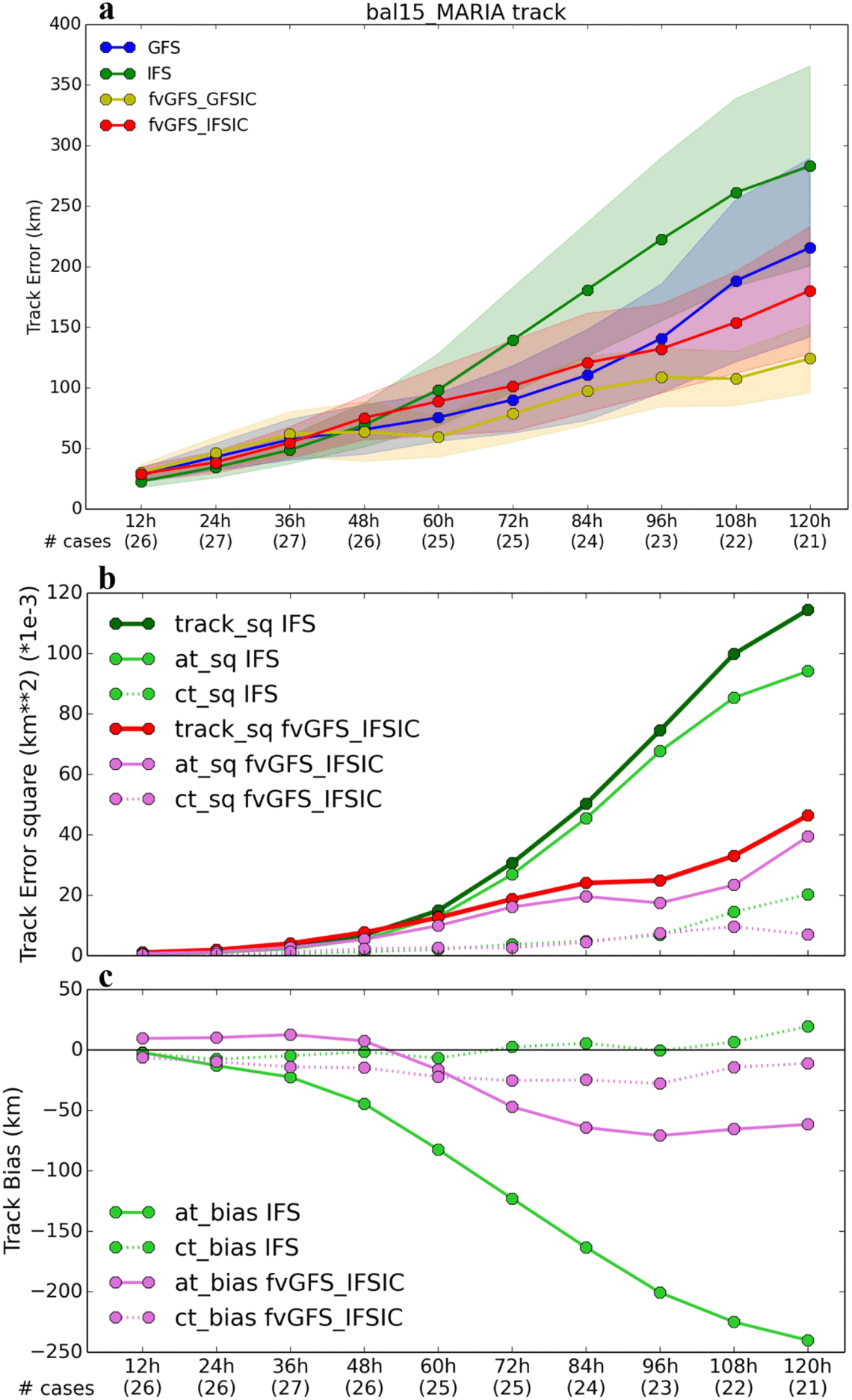
- The fvGFS greatly improved the ECMWF’s poor track forecast for Hurricane Maria. For Hurricane Irma, a ECMWF well-predicted case, the fvGFS still had slightly lower 5-day track forecast errors.
- The fvGFS also shows better model predicted storm intensities than both the United States and the ECMWF operational models.
Jan-Huey Chen, Shian-Jiann Lin, Linus Magnusson, Morris Bender, Xi Chen, Linjiong Zhou, Baoqiang Xiang, Shannon Rees, Matthew Morin and Lucas Harris. Geophysical Research Letters. DOI: 10.1029/2019GL082410
When using European Centre for Medium‐Range Weather Forecasts (ECMWF) initial conditions, a new global weather model built at NOAA’s Geophysical Fluid Dynamics Laboratory produces better hurricane forecast skill than the world‐leading European model.
Hurricane, or tropical cyclone, prediction has long been an important mission for weather forecast agencies to help mitigate hazards along coastlines and inland. In the United States, NOAA’s Global Forecast System (GFS) provides the front‐line guidance for hurricane forecasts. The new GFS was recently updated to include the Finite‐Volume Cubed‐Sphere Dynamical Core (FV3) developed at GFDL. Benefiting from the accuracy, scalability, and computational efficiency of FV3, the future GFS model is expected to provide a great opportunity for the unification of weather and climate prediction systems.
A new full physics global model, called fvGFS, was built at GFDL for testing the robustness of the dynamical core under a wide range of realistic atmospheric initial conditions. Different from the new operational GFS, the GFDL fvGFS is being developed mostly as a research model and includes more advanced dynamical and physical algorithms. Real‐time 10‐day fvGFS forecasts are run every 6 hours at GFDL and are publicly available online.
Using the fvGFS model developed at GFDL, the authors demonstrate the potential of this new system on hurricane prediction. A sophisticated regridding tool to ingest initial conditions from two prominent global prediction systems, the current GFS and the ECMWF’s IFS, was developed to investigate the impact of the ICs on the forecast performance.
The fvGFS retrospective forecasts initialized with the ECMWF data showed better track forecasts for the 2017 Atlantic hurricane season compared to the best performing ECMWF operational model. The fvGFS greatly improved the ECMWF’s poor track forecast for Hurricane Maria. For Hurricane Irma, which was well predicted by the ECMWF model, the fvGFS still had slightly lower 5-day track forecast errors. Forecasting TC intensity has remained a challenge for all global models, and the fvGFS also shows better model predicted storm intensities than both the United States and the ECMWF operational models, indicating the robustness of its numerical approaches.